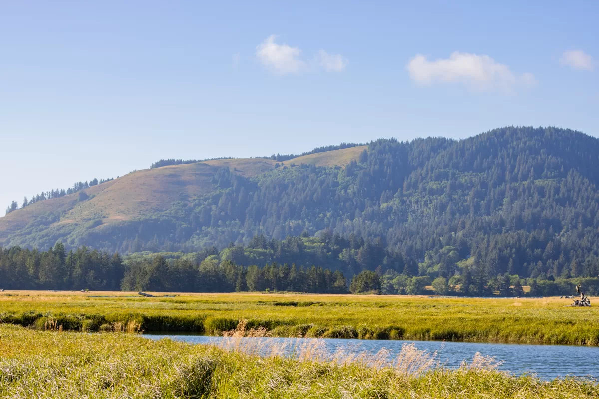
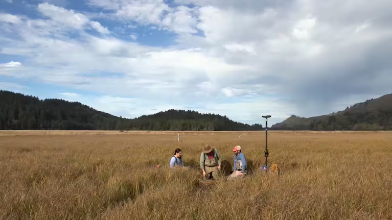
What secrets lie in the depths of coastal soil? This is a question that researchers from Virginia Tech visiting Westwind attempted to answer. Traversing the edges of Westwind, they traveled to the eastern tip of the Salmon River estuary. These researchers used long metal rods to pull layered samples from the river bank. The soil samples collected three feet of sediment filled with fossilized microorganisms and coded with the area’s geological history. Careful examination of these elements allowed researchers to build a historical account of systemic activity along the Oregon coast. This research could provide vital information to help protect us from future earthquakes and tsunamis.
Seismic History
Roughly 300 years ago, the subducting Juan de Fuca plate broke free and caused a massive earthquake along the Oregon coast. The earthquake resulted from massive amounts of pressure between the Juan de Fuca plate and the North American plate. This pressure point, where the Juan de Fuca plate is pulled under the North American plate, is located 100 miles off the Oregon coast. It builds up pressure over hundreds of years. When it reaches its breaking point it snaps. This snap raises the relative sea level as much as six feet. This snap causes a tsunami. Massive amounts of water rush onto the land. In the soil samples pulled by these researchers, they discovered a band of sand that showed the effects of the tsunami from the last earthquake.
Researching for the Future
Currently, the subduction zone off the coast of Oregon and Washington is building up pressure. It will need to be released again. The effects could be devastating for coastal communities. That is why researchers are hard at work planning for the next major earthquake. Soil samples allow scientists to look back at past earthquakes and learn from their effects. The soil samples taken from the Salmon River Estuary show that the waves of the last major tsunami traveled much further inland than they previously thought. Scientists and emergency planners use this data to predict the effects of the next major earthquake and help coastal communities prepare. This includes establishing safe evacuation routes, building emergency caches outside of the tsunami zone, and delivering information.
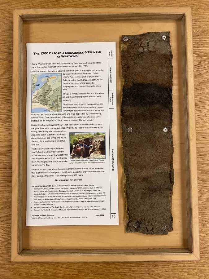
Soil Peel
We are lucky enough to have a soil peel from the Salmon River Estuary. Collected by geologist Dr. Brian Atwater while researching at Westwind, this peel will be on display at Westwind. The peel includes many incredible details. The top layer is estuary mud that has slowly been deposited by the Salmon River. The lower layers include the band of sand deposited by the last tsunami and a band of charcoal from an Indigenous fire pit or oven. Below that layer is nearly a foot of river mud and sand from when the Salmon River was much higher than it is today.
Thank you so much to Westwind Thanksgiving Group member and former board member Peter Samson for preparing the Soil Peel display. Make sure to check it out next time you visit!